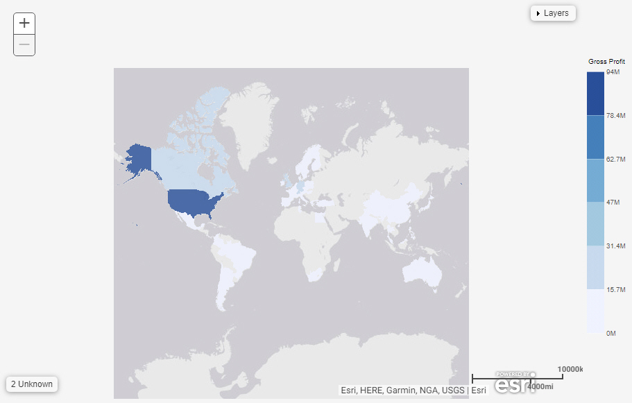
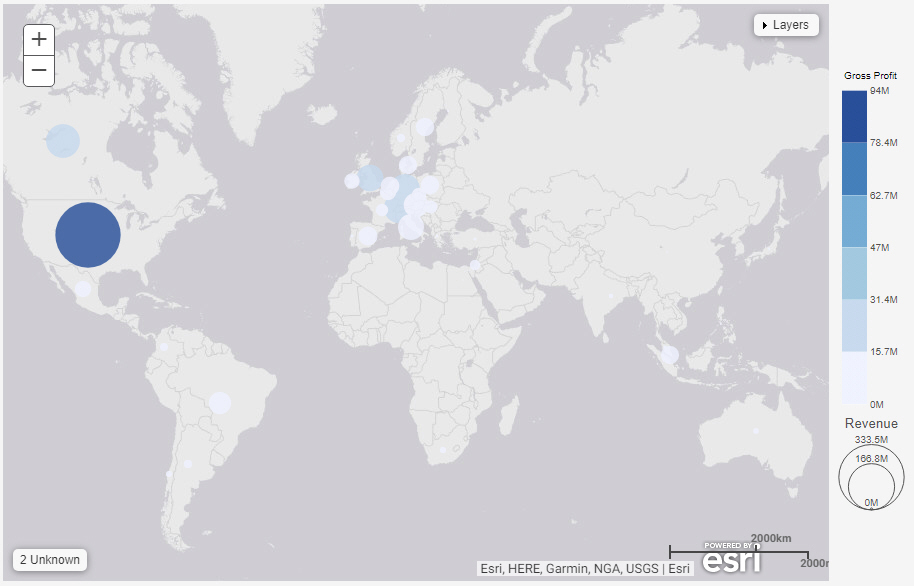
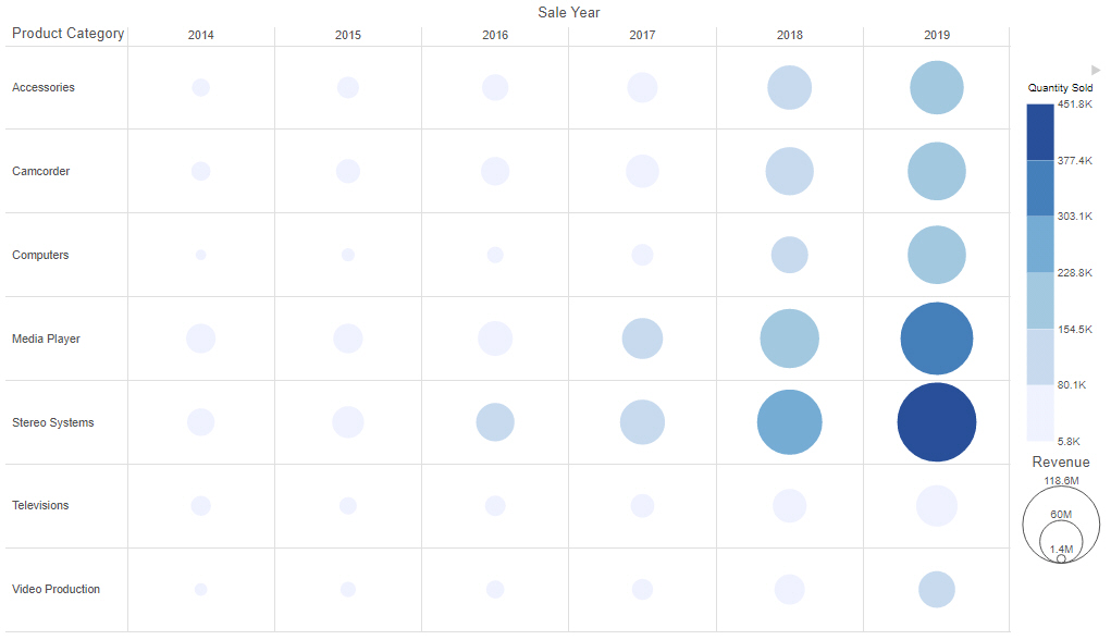
8207


Adding Headings and Footings to a Chart

You can use headers and footers to add key information, such as the purpose of the chart and the audience. For example, if you have gross profit for different product categories, you can add a header to highlight this information in your chart.

You can add multiple lines of information into the heading and footing areas in a chart. This accommodates thorough explanations and additional information while offering the most readable presentation.

Controlling Font Display in a Chart

You can use the font formatter in WebFOCUS Designer to control how fonts are displayed in your chart. This is a quick way to apply styling, colors, or a specific font type for any text within your chart. The font formatter displays in different areas of the Format tab (for example, Legend, Axis, Series, and Matrix options). Depending on the chart type and what you want to format, you can use these options to enhance the fonts in your charts. The font formatter is shown in the following image.

Formatting Charts

Charts allow you to present information graphically, using such visual cues as color, size, and position to convey relationships between measures (numeric fields to be aggregated) and dimensions (categories) and to identify trends and outliers. You can create a wide variety of charts. For example, you can review your data (Gross Profit and Product Category) using different chart types (for example, bar chart, area chart, or line chart). The chart options give you an edge in deciding which chart to use to highlight certain information or trends.

Creating Choropleth Maps

Choropleth maps can be used to create geographically-based heat maps. They are useful for visualizing location-based data, trends, and distributions across a geographic area, as shown in the following image.


Note: Choropleth maps require at least one measure and one Georole, which contains geographic location information. You can add a field to the Color bucket to color the map.

The following display options are available for a choropleth map.

Creating Proportional Symbol Maps

Proportional symbol maps, or bubble maps, use symbols of different sizes to represent data associated with different areas or locations within the map, as shown in the following image.


Note: Proportional symbol maps require at least one measure and one Georole, which contains geographic location information. You can add a field to the Color bucket to color the map.

The following display options are available for a proportional symbol map.

Creating Matrix Marker Charts

Matrix marker charts can be used to analyze one or two measures against a crosstab of two categorical dimensions. The result is a color scaled matrix chart that shows categorized trends, as shown in the following image.


Note: Matrix marker charts require at least two measures and two dimensions. It also requires a field in the Color and Size buckets, which allow you to see the concentration of data for that intersection of the chart.

Creating Data Grid Charts

A data grid is a kind of chart that can be used to present data in tabular form. For example, you can create a grid (table) that summarizes your data. Data grids include sorting and tooltip features by default, unlike tabular reports. An example of a data grid is shown in the following image.